L. Bistrup Brae
| L. Bistrup Brae | |
|---|---|
| L. Bistrup Bræ | |
 L. Bistrup Brae to the right, east of the Eventyrfjelde. | |
| Type | Piedmont glacier |
| Location | Queen Louise Land |
| Coordinates | 76°15′N 23°15′W / 76.250°N 23.250°W |
| Width | 18 km (11 mi) |
| Terminus | Borg Fjord through Bredebrae; North Atlantic Ocean |
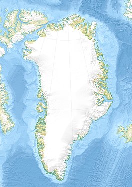
L. Bistrup Brae (Danish: L. Bistrup Bræ) is a glacier in Northeastern Greenland.[1] Administratively it belongs to the Northeast Greenland National Park.
History
[edit]The glacier was first mapped during the 1906–08 Danmark Expedition. It was named by expedition member Henning Bistrup as L. Bistrupsbræ, after his father Lauritz Hans Christian Bistrup (1850 – 1914).[2]
Geography
[edit]L. Bistrup Brae is one of the main glaciers in the area. It flows roughly northwards from the northeastern limits of the Greenland Ice Sheet between southern Queen Louise Land to the west and Rechnitzer Land to the east. The A.B. Drachmann Glacier and the Budolfi Isstrom join it from the west. Its breadth can reach 18 km (11 mi), slightly bending to the NNE in its last stretch. The glacier has its terminus in the Borg Fjord through the Bredebrae, near the southern end of Storstrommen.[2][3]
 |
See also
[edit]References
[edit]- ^ Google Earth
- ^ a b "Place names, northern East Greenland". data.geus.dk. Retrieved 2023-10-17.
- ^ Storstrømmen and L. Bistrup Bræ, North Greenland, Protected From Warm Atlantic Ocean Waters
External links
[edit]- Ice Recession in Dronning Louise Land, North-East Greenland
- Insights on the Surge Behavior of Storstrømmen and L. Bistrup Bræ, Northeast Greenland

